
Loch na Cathrach Pumped Storage Hydro Scheme
Statkraft acquired the consented Loch na Cathrach (formerly known as Red John) Pumped Storage Hydro Scheme from Intelligent Land Investments Group (ILI) in December 2023.
The acquisition demonstrates Statkraft’s latest commitment to helping Scotland meet its renewable energy targets and strengthening the UK's energy security.
This website will provide updates on our work towards bringing the project into construction.
About the project
Loch na Cathrach Pumped Storage is a 450MW hydro scheme, first conceived in 2015 and granted consent by Scottish Government ministers in June 2021 (REF: ECU00000728).
Located on a site around 14km south-west of Inverness, this development will harness the waters of Loch Ness, helping the deployment of more renewable power and reducing our carbon emissions. It will capture excess energy, and store it until needed, helping provide security of supply as Great Britain’s electricity network shifts away from fossil fuels.
This significant UK renewable energy infrastructure project will support hundreds of jobs during construction and provide locally-based permanent jobs once operational.

What the project will look like and how it operates
Articles


What is pumped storage?
What is pumped storage? Pumped storage is a way of storing energy by turning electrical energy into stored (or potential) energy and back again to electrical energy. The system uses electricity to...
Read more
Local Suppliers
Our aim is to have the least impact and provide the most benefit to the communities in which we operate. The construction phase is one way we can create economic benefits through inward investment, a...
Read moreConstruction timeline
The project team


Related articles
Statkraft to acquire major Loch Ness pumped storage hydro project from Intelligent Land Investments Group
The acquisition demonstrates Statkraft’s latest commitment to helping Scotland meet its renewable energy targets and strengthening UK energy security
Read more

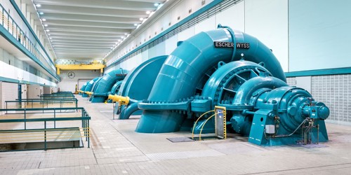
Hydropower
At Statkraft, we have 125 years of experience in hydropower and are the largest producer of electricity from hydropower in Europe. The majority of our power production is hydropower.
Read more

What is pumped storage?
What is pumped storage? Pumped storage is a way of storing energy by turning electrical energy into stored (or potential) energy and back again to electrical energy. The system uses electricity to...
Read more
Learn more about Statkraft
The history of Statkraft
A short animated video of the History of Statkraft
Statkraft's history
A deep dive into over 125-years of history, as Europe's largest renewable energy producer.
Hydro power - how does it work?
Learn how hydro power is generating power.
Decide your future
What kind of world would you choose?
Member of

![]()